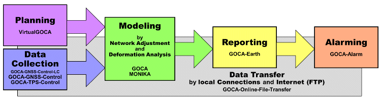
GOCA-Modules
GOCA-Online-File-Transfer
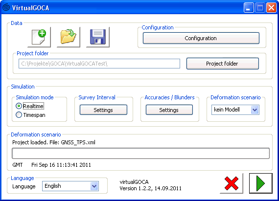
GNSS-/LPS-Sensordata-Simulator
The GOCA module Virtual-GOCA creates in given sampling rates the observation data (GNSS, terrestrial TPS, levelling or hydrostatic levelling) for a virtual geo-monitoring-array, which is designed in GoogleEarth. The network information is provided als kml-file from Google-Earth. Using the geographical latitude and longitude coordinates, a digital terrain model, as well as a geopotential model, the 3D point-positions, the direction of the vertical deflections and the geoid undulation can be evaluated. Based on the observation equations of a three-dimensional integrated network adjustement, the above mentioned GNSS and LPS sensor-data are created and provided by the open GOCA GKA-data interface.
Virtual-GOCA can be used due to its generally and clearly defined GKA-Interface for the validation and testing of any Geomonitoring-software, as well as for an a priori planning of the design of geo-monitoring-arrays and their sensitivity for the detection of deformations.
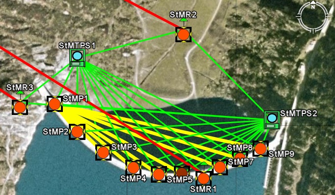
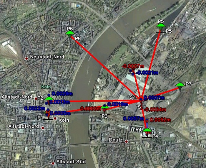
GoogleEarth-Visualisation
Visualisation of deformation arrays (stable points, object points) in GoogleEarth™. Online and postprocessing visualisation of deformation states in GoogleEarth™ with interface to current the FIN- and MVE-Coordinates from the GOCA-Analysis. Sensorpicture presentation with further information of the sensor position and the current deformation state (FIN, MVE) by mouseclick on the point symbol.
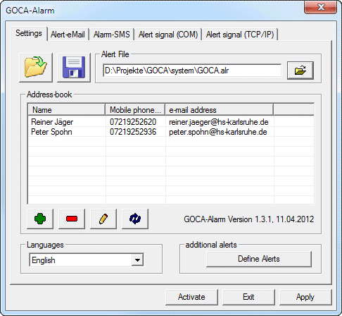
Alert-Software
This software alerts when critical states and / or statistically significant deformation is reached. A predefined alarm plan (Email, SMS) for important people and a relai-switch (siren, beacon) can be used.
Open Interface: ALR-File (based on MVE-, SHT-, KAL- and VHS-Alerts, as well as Alerts-Strings from other GOCA-Modules)